Navigation Apps:
The best way to navigate is to use an app on your phone. The app I use is Gaia GPS, but you can use others too. The free version is fine. You can download a gpx file from this web site onto your app and it will show you the route and your location on the route. You do not need cell service to have it track you, BUT you must download the file into your app AND make sure you have charged your battery. It's not a bad idea to turn off your cellular signal when you are running because looking for signal uses up battery pretty quickly. If you have never used a tracking app before, I suggest you try it a couple times while doing a route you are familiar with before relying on it for navigation. You can use the app to navigate to the start, or just use these directions.
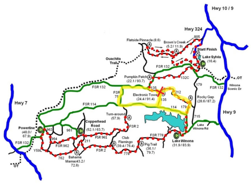
Driving directions to START (Old Electronic Tower Aid Station)
From Lake Sylvia day use parking lot, continue past the parking lot up the hill on Hwy 324. Turn R at the top of the hill following CR 132. Go left at the "Y" intersection continuing on CR 132. Turn L onto CR 135 more than a mile past "Y". Continue L at next "Y". Park in the open place at the top of hill after about 1/2 mile.
Notes for this loop:
Most people start this run heading back down CR 135 the way you drove in so that you come up Cork Screw Hill in the middle. They then head east on CR 212 so they hit the hill again at the end.
CR 212 can be grassy in the summer. Sometimes conditions are posted on Facebook or you can just ask on the Facebook Traveller page if anyone has gone down 212 lately.
HOME AURA NEWS UTS Back to Trails