Navigation Apps:
The best way to navigate is to use an app on your phone. The app I use is Gaia GPS, but you can use others too. The free version is fine. You can download a gpx file from this web site onto your app and it will show you the route and your location on the route. You do not need cell service to have it track you, BUT you must download the file into your app AND make sure you have charged your battery. It's not a bad idea to turn off your cellular signal when you are running because looking for signal uses up battery pretty quickly. If you have never used a tracking app before, I suggest you try it a couple times while doing a route you are familiar with before relying on it for navigation. You can use the app to navigate to the start, or just use these directions.
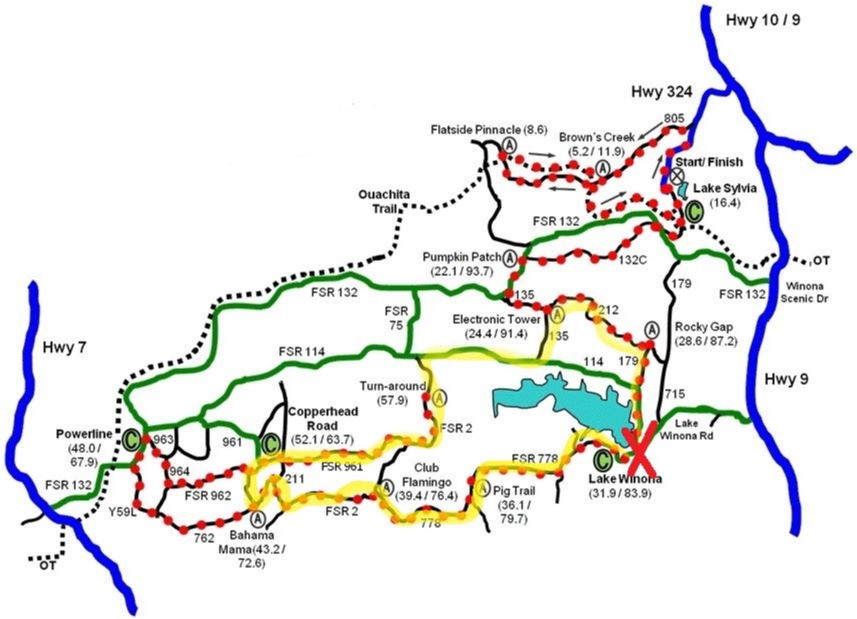
Driving directions to day use area
From William's Junction (intersection of Hwy 9 and 10) go south on Hwy 9 5.7 miles and turn right onto Lake Winona Road (some navigation systems may call this FSR 778). Follow this for 0.9 mile, at which point you must make a right turn to stay on Lake Winona Road. Follow approximately 3 more miles to intersection with Reform Road/FSR 114 (right) and FSR 778 (straight). Go right at the intersection, up the hill and turn left into the day use area.
Notes for this loop:
If you go counter clockwise, you go down Cork Screw Hill which is the biggest hill in the route. It will be about 5 miles in.
Hwy 212 can be grassy in the summer. Sometimes people will post more current trail info on Facebook.
This is a long loop, so make sure you have plenty of water or ideally, drop water about half way through.
HOME AURA NEWS UTS Back to Trails